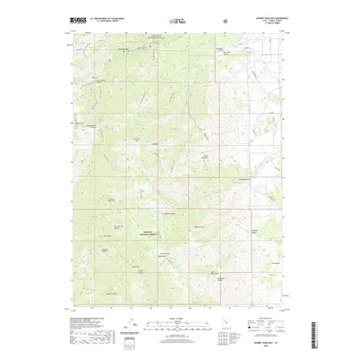
2020 Map of Deseret Peak East
USGS Topo · Published 2020About this map
Deseret Peak dominates the high alpine landscape of the northern Stansbury Mountains, where the Wasatch National Forest protects a complex system of drainage and relief. The topography is defined by sharp canyons and narrow passages, such as the Mining Fork of South Willow Canyon, Upper Narrows, and Lower Narrows, which channel seasonal water toward the valley floor. High-altitude landmarks like South Willow Lake and peaks such as Vickory Mtn and Bald Mtn mark the ridgelines. Numerous seasonal springs, including Buck Spring and Chokecherry Spring, provide critical water points in this arid environment. The road network on the eastern slopes, featuring Prospector Ln and Aqueduct Rd, reflects the area's history of resource management and local access.
Find a feature on this map
58 named features on this map. Tap any name to fly to it.
Don’t see what you’re looking for? This feature index may not catch every label — zoom into the map to look around manually.
Map Details
Editions of this 2020 Deseret Peak East Map
This is the sole edition of this map. No revisions or reprints were ever made.
Other maps of this area

1885 · Tooele Valley
USGS Topo · 1:250,000

1918 · Stockton
USGS Topo · 1:62,500

1953 · Tooele
USGS Topo · 1:250,000

1955 · Timpie
USGS Topo · 1:62,500

1955 · Deseret Peak
USGS Topo · 1:62,500

1955 · Grantsville
USGS Topo · 1:24,000

1955 · Stockton
USGS Topo · 1:62,500

1955 · Tooele
USGS Topo · 1:250,000

1979 · Rush Valley
USGS Topo · 1:100,000
1979 · Tooele
USGS Topo · 1:100,000