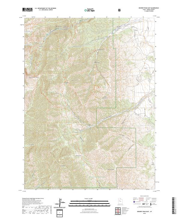
2023 Map of Deseret Peak East
USGS Topo · Published 2023About this map
The Stansbury Mountains anchor this 2023 survey of the high-elevation terrain west of Tooele. The landscape is defined by the protected boundaries of the Deseret Peak Wilderness and Wasatch National Forest, where steep drainages like South Willow Canyon and Indian Hickman Canyon fall away from prominent summits. Hikers and researchers can trace the long path of the Stansbury Crest Trl as it navigates high-altitude crossings at Box Elder Pass and Hickman Pass, connecting peaks such as Bald Mtn and Vickory Mtn.
Find a feature on this map
56 named features on this map. Tap any name to fly to it.
Don’t see what you’re looking for? This feature index may not catch every label — zoom into the map to look around manually.
Map Details
Editions of this 2023 Deseret Peak East Map
This is the sole edition of this map. No revisions or reprints were ever made.
Other maps of this area

1885 · Tooele Valley
USGS Topo · 1:250,000

1918 · Stockton
USGS Topo · 1:62,500

1953 · Tooele
USGS Topo · 1:250,000

1955 · Timpie
USGS Topo · 1:62,500

1955 · Deseret Peak
USGS Topo · 1:62,500

1955 · Grantsville
USGS Topo · 1:24,000

1955 · Stockton
USGS Topo · 1:62,500

1955 · Tooele
USGS Topo · 1:250,000

1979 · Rush Valley
USGS Topo · 1:100,000
1979 · Tooele
USGS Topo · 1:100,000