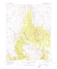
1956 Map of Desert Creek Peak
USGS Topo · Published 1974About this map
The Walker River meanders through the northwest corner of this 1950s survey, marking a vital water source for the agricultural operations in Antelope Valley. Irrigation infrastructure is prominent throughout the lowlands, including the Saroni Canal, Gray Hills Canal, and Highline Canal, which supported the early 20th-century ranching life at places like Rosaschi Ranch. The terrain rises sharply into the Wellington Hills and Pine Nut Mountains, where the landscape transitions from fertile river bottoms to a mineral-rich highland. Prospecting and extraction are evident at the Boulder Hill Mine and Smith Valley Mine, while the southern reaches are dominated by the high peaks of the Toiyabe National Forest. This map captures a remote frontier where the state line between Nevada and California cuts across the Sweetwater Mts, through a network of canyons like Risue Canyon and Rickey Canyon.
Find a feature on this map
81 named features on this map. Tap any name to fly to it.
Don’t see what you’re looking for? This feature index may not catch every label — zoom into the map to look around manually.
Map Details
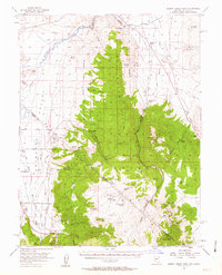
Editions of this 1956 Desert Creek Peak Map
3 editions found

Other maps of this area

1889 · Markleeville
USGS Topo · 1:125,000

1891 · Markleeville
USGS Topo · 1:125,000

1891 · Wellington
USGS Topo · 1:125,000

1893 · Markleeville
USGS Topo · 1:125,000

1893 · Wellington
USGS Topo · 1:125,000

1896 · Dardanelles
USGS Topo · 1:125,000

1898 · Dardanelles
USGS Topo · 1:125,000

1909 · Bridgeport
USGS Topo · 1:125,000

1911 · Bridgeport
USGS Topo · 1:125,000

1920 · Bridgeport
USGS Topo · 1:125,000