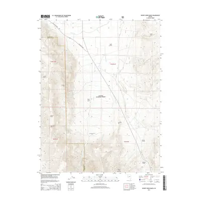
2014 Map of Desert Creek Ranch
USGS Topo · Published 2014About this map
Desert Creek Ranch sits at the base of the Desert Creek Mountains in this 2014 study of the Nevada landscape where Lyon and Douglas counties meet. The transition from the high peaks of the Toiyabe National Forest to the floor of Smith Valley is defined by a series of deep canyons, including Dalzell Canyon and O'Banion Canyon. This area illustrates a classic western high-desert agricultural pattern, where water management is central to the land's utility. The Saroni Canal and Plymouth Canal trace the upper reaches of the valley, diverting water to support the ranching operations near the Wellington Cutoff. The presence of the Desert Creek Airport suggests the continued importance of this remote ranching outpost, while the surrounding Wellington Hills and Boulder Hill remain largely undeveloped high ground.
Find a feature on this map
24 named features on this map. Tap any name to fly to it.
Don’t see what you’re looking for? This feature index may not catch every label — zoom into the map to look around manually.
Map Details
Editions of this 2014 Desert Creek Ranch Map
This is the sole edition of this map. No revisions or reprints were ever made.
Other maps of this area

1891 · Wellington
USGS Topo · 1:125,000

1893 · Wellington
USGS Topo · 1:125,000

1948 · Walker Lake
USGS Topo · 1:250,000

1956 · Desert Creek Peak
USGS Topo · 1:62,500

1957 · Walker Lake
USGS Topo · 1:250,000

1957 · Wellington
USGS Topo · 1:62,500

1957 · Yerington
USGS Topo · 1:62,500

1958 · Pine Grove Hills
USGS Topo · 1:62,500

1962 · Walker Lake
USGS Topo · 1:250,000

1964 · Walker Lake
USGS Topo · 1:250,000