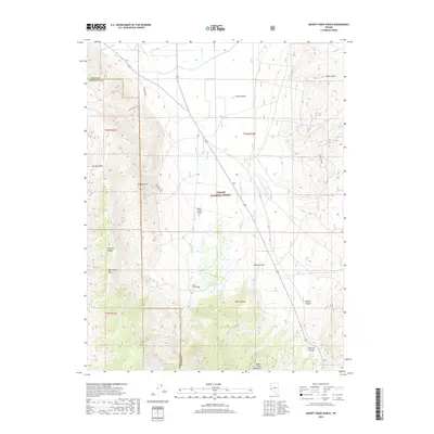
2018 Map of Desert Creek Ranch
USGS Topo · Published 2018About this map
Smith Valley and the Desert Creek Ranch dominate this high-desert landscape on the border of Lyon and Douglas counties. Water management is a primary feature of the northern terrain, where the Plymouth Canal and Saroni Canal move water through the valley floor. To the south, the topography rises sharply into the Desert Creek Mountains and Wellington Hills, protected as part of the Toiyabe National Forest. This 2018 survey reveals the infrastructure of the rural west, from the remote Jackpot Mine in the east to the Desert Creek Airport and the Wellington Spur road. The transition from irrigated agricultural valley to steep, drainage-carved slopes like Dalzell Canyon and O'Banion Canyon defines the region's ranching and resource economy.
Find a feature on this map
25 named features on this map. Tap any name to fly to it.
Don’t see what you’re looking for? This feature index may not catch every label — zoom into the map to look around manually.
Map Details
Editions of this 2018 Desert Creek Ranch Map
This is the sole edition of this map. No revisions or reprints were ever made.
Other maps of this area

1891 · Wellington
USGS Topo · 1:125,000

1893 · Wellington
USGS Topo · 1:125,000

1948 · Walker Lake
USGS Topo · 1:250,000

1956 · Desert Creek Peak
USGS Topo · 1:62,500

1957 · Walker Lake
USGS Topo · 1:250,000

1957 · Wellington
USGS Topo · 1:62,500

1957 · Yerington
USGS Topo · 1:62,500

1958 · Pine Grove Hills
USGS Topo · 1:62,500

1962 · Walker Lake
USGS Topo · 1:250,000

1964 · Walker Lake
USGS Topo · 1:250,000