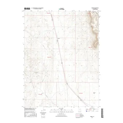
2017 Map of Desert
USGS Topo · Published 2017About this map
Desert serves as the central point of interest in this 2017 survey of the arid Utah landscape, situated where the Moab to Boulder Town route traverses the high desert floor. The geography is defined by the dramatic rise of the Book Cliffs to the northeast, where the elevation climbs sharply toward Mid Mtn and the mouth of Blue Castle Canyon. The map reveals a network of historical transportation routes, including the Smith Camp RR Grade and the Buckmaster Rd, which cut through the southern reaches near the Gunnison Valley. Water remains a vital but scarce feature in this terrain, marked primarily by isolated points like Trail Spring. The survey provides a clear view of how modern transit lines follow established pathways through the rugged topography of Emery County.
Find a feature on this map
18 named features on this map. Tap any name to fly to it.
Don’t see what you’re looking for? This feature index may not catch every label — zoom into the map to look around manually.
Map Details
Editions of this 2017 Desert Map
This is the sole edition of this map. No revisions or reprints were ever made.
Other maps of this area

1885 · San Rafael
USGS Topo · 1:250,000

1886 · Price River
USGS Topo · 1:250,000

1896 · Price River
USGS Topo · 1:250,000

1953 · Beckwith Peak SW
USGS Topo · 1:24,000

1953 · Tidwell 2 NW
USGS Topo · 1:24,000

1954 · Tidwell 2 NE
USGS Topo · 1:24,000

1954 · Tidwell 1 NW
USGS Topo · 1:24,000

1954 · Tidwell Bottoms
USGS Topo · 1:62,500

1954 · Green River
USGS Topo · 1:62,500

1956 · Salina
USGS Topo · 1:250,000