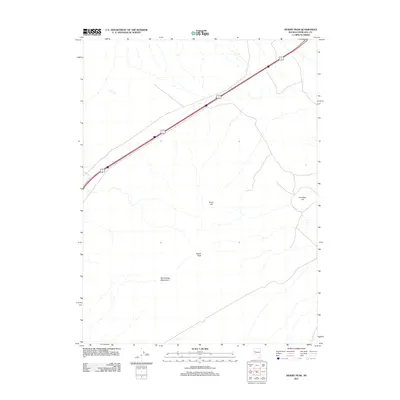
2011 Map of Desert Peak
USGS Topo · Published 2011About this map
Hot Springs Mountains dominate the southern reach of this arid Churchill County landscape, characterized by isolated peaks and high desert terrain. The prominence of Desert Peak stands as the central landmark, while smaller elevations like Green Hill and Cinnabar Hill punctuate the surrounding basins. This 2011 survey by the U.S. Geological Survey shows a region defined primarily by its topographic relief and sparse infrastructure, where human activity is largely concentrated along major transportation corridors. The diagonal passage of U.S. Route 95 Alternate and the northern corner of Interstate 80 provide the primary access through this open country, illustrating the importance of transit routes in connecting the remote interior of Nevada. The lack of named settlements or developments outside of these corridors underscores the preserved natural character of the high desert range.
Find a feature on this map
6 named features on this map. Tap any name to fly to it.
Don’t see what you’re looking for? This feature index may not catch every label — zoom into the map to look around manually.
Map Details
Editions of this 2011 Desert Peak Map
This is the sole edition of this map. No revisions or reprints were ever made.
Other maps of this area

1890 · Wadsworth
USGS Topo · 1:125,000

1892 · Wadsworth
USGS Topo · 1:125,000

1894 · Wadsworth
USGS Topo · 1:125,000

1908 · Carson Sink
USGS Topo · 1:250,000

1910 · Carson Sink
USGS Topo · 1:250,000

1951 · Soda Lake
USGS Topo · 1:62,500

1951 · Desert Peak
USGS Topo · 1:62,500

1957 · Fireball Ridge
USGS Topo · 1:62,500

1957 · Two Tips
USGS Topo · 1:62,500

1957 · Reno
USGS Topo · 1:250,000