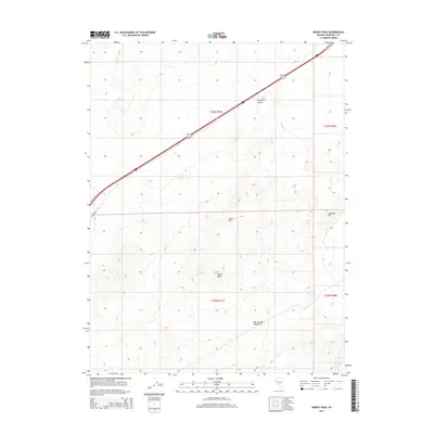
2014 Map of Desert Peak
USGS Topo · Published 2014About this map
Desert Peak and the surrounding Hot Springs Mountains dominate this high-desert landscape in northern Churchill County. The map provides a detailed view of the rugged terrain within the Fortymile Desert, a region historically known for its difficult passage by emigrants on the California Trail. Modern infrastructure is represented by the diagonal corridor of Interstate 80 and Alt 95, which cut through the arid basins. Traces of earlier travel are visible in the alignment of Old Highway 40 in the western section. Local topography is further defined by landmarks such as Green Hill and Cinnabar Hill, situated within the complex township and range grid of T23N and T22N.
Find a feature on this map
12 named features on this map. Tap any name to fly to it.
Don’t see what you’re looking for? This feature index may not catch every label — zoom into the map to look around manually.
Map Details
Editions of this 2014 Desert Peak Map
This is the sole edition of this map. No revisions or reprints were ever made.
Other maps of this area

1890 · Wadsworth
USGS Topo · 1:125,000

1892 · Wadsworth
USGS Topo · 1:125,000

1894 · Wadsworth
USGS Topo · 1:125,000

1908 · Carson Sink
USGS Topo · 1:250,000

1910 · Carson Sink
USGS Topo · 1:250,000

1951 · Soda Lake
USGS Topo · 1:62,500

1951 · Desert Peak
USGS Topo · 1:62,500

1957 · Fireball Ridge
USGS Topo · 1:62,500

1957 · Two Tips
USGS Topo · 1:62,500

1957 · Reno
USGS Topo · 1:250,000