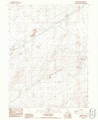
1986 Map of Desert Peak
USGS Topo · Published 1986About this map
Desert Peak stands as the prominent high point in this mid-1980s survey of the Nevada high desert. The landscape is defined by the intersection of the Trinity Range and the Hot Springs Mountains, where rugged topography meets the expanse of the Fortymile Desert. The map reveals a region heavily shaped by mineral exploration and energy development, marked by numerous prospects and distinct mining operations like the Fallon Eagle Mine and Desert Queen Mine near Cinnabar Hill. The presence of a Geothermal Well in the southern reaches highlights the area's transition toward modern energy extraction, while the Double Wood Pole Trans Line cuts a straight path across the desert floor, following the corridor of ancient migratory routes through this arid terrain.
Find a feature on this map
15 named features on this map. Tap any name to fly to it.
Don’t see what you’re looking for? This feature index may not catch every label — zoom into the map to look around manually.
Map Details
Editions of this 1986 Desert Peak Map
This is the sole edition of this map. No revisions or reprints were ever made.
Other maps of this area

1890 · Wadsworth
USGS Topo · 1:125,000

1892 · Wadsworth
USGS Topo · 1:125,000

1894 · Wadsworth
USGS Topo · 1:125,000

1908 · Carson Sink
USGS Topo · 1:250,000

1910 · Carson Sink
USGS Topo · 1:250,000

1951 · Soda Lake
USGS Topo · 1:62,500

1951 · Desert Peak
USGS Topo · 1:62,500

1957 · Fireball Ridge
USGS Topo · 1:62,500

1957 · Two Tips
USGS Topo · 1:62,500

1957 · Reno
USGS Topo · 1:250,000