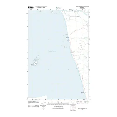
2011 Map of Destruction Island
USGS Topo · Published 2011About this map
The Destruction Island Lighthouse stands as a sentinel over the rocky Washington coastline, a primary feature of this survey where the Hoh River meets the Pacific Ocean. This coastal landscape is defined by its sea stacks and offshore hazards, including North Rock, Middle Rock, and Abbey Island. Along the shore, Ruby Beach and the Destruction Island Viewpoint provide perspectives on a rugged littoral zone where numerous waterways like Steamboat Creek and Cedar Creek discharge into the sea.
Find a feature on this map
19 named features on this map. Tap any name to fly to it.
Don’t see what you’re looking for? This feature index may not catch every label — zoom into the map to look around manually.
Map Details
Editions of this 2011 Destruction Island Map
This is the sole edition of this map. No revisions or reprints were ever made.
Other maps of this area

1939 · Forks
USGS Topo · 1:62,500

1943 · Copalis Beach
USGS Topo · 1:250,000

1951 · Copalis Beach
USGS Topo · 1:250,000

1956 · Destruction Island
USGS Topo · 1:62,500

1956 · La Push
USGS Topo · 1:62,500

1957 · Forks
USGS Topo · 1:62,500

1957 · Copalis Beach
USGS Topo · 1:250,000

1963 · Copalis Beach
USGS Topo · 1:250,000
1982 · Toleak Point
USGS Topo · 1:24,000
1982 · Destruction Island
USGS Topo · 1:24,000