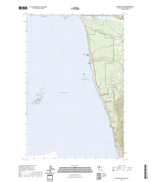
2023 Map of Destruction Island
USGS Topo · Published 2023About this map
Destruction Island stands as the prominent landmark of this coastal survey, situated offshore from the Jefferson County mainland. The landscape is defined by the meeting of the Pacific Ocean and the Olympic Peninsula, where the Hoh River discharges into the sea near Oil City Rd. This contemporary data shows the extensive protected lands of Olympic National Park and the Washington Islands Wilderness, encompassing distinctive geological features like North Rock, Middle Rock, and Abbey Island.
Find a feature on this map
28 named features on this map. Tap any name to fly to it.
Don’t see what you’re looking for? This feature index may not catch every label — zoom into the map to look around manually.
Map Details
Editions of this 2023 Destruction Island Map
This is the sole edition of this map. No revisions or reprints were ever made.
Other maps of this area

1939 · Forks
USGS Topo · 1:62,500

1943 · Copalis Beach
USGS Topo · 1:250,000

1951 · Copalis Beach
USGS Topo · 1:250,000

1956 · Destruction Island
USGS Topo · 1:62,500

1956 · La Push
USGS Topo · 1:62,500

1957 · Forks
USGS Topo · 1:62,500

1957 · Copalis Beach
USGS Topo · 1:250,000

1963 · Copalis Beach
USGS Topo · 1:250,000
1982 · Toleak Point
USGS Topo · 1:24,000
1982 · Destruction Island
USGS Topo · 1:24,000