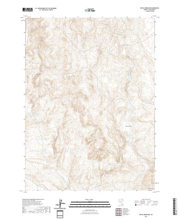
2021 Map of Devils Armchair
USGS Topo · Published 2021About this map
The Devils Armchair formation serves as a central landmark in this Elko County landscape, where the terrain is defined by the complex drainage systems of the E Fork Beaver Cr and W Fork Beaver Cr. This region of Nevada is characterized by its numerous water sources, vital for ranching and wildlife in an arid environment, including Beaver Spring, Coupling Spring, and Mcconnell Spring. The geography shows a network of named heights and fields, such as Rim Rock and Mexican Field, which speak to the localized nomenclature used by land managers and residents.
Find a feature on this map
20 named features on this map. Tap any name to fly to it.
Don’t see what you’re looking for? This feature index may not catch every label — zoom into the map to look around manually.
Map Details
Editions of this 2021 Devils Armchair Map
This is the sole edition of this map. No revisions or reprints were ever made.
Other maps of this area

1935 · Charleston
USGS Topo · 1:48,000

1942 · Mt. Velma
USGS Topo · 1:62,500

1955 · Wells
USGS Topo · 1:250,000

1958 · Wells
USGS Topo · 1:250,000

1961 · Wells
USGS Topo · 1:250,000

1967 · Hanks Creek SW
USGS Topo · 1:24,000

1967 · Stag Mountain
USGS Topo · 1:24,000

1968 · Charleston Reservoir
USGS Topo · 1:24,000

1971 · Double Mtn
USGS Topo · 1:24,000

1971 · Devils Armchair
USGS Topo · 1:24,000