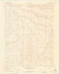
1960 Map of Devils Gulch
USGS Topo · Published 1963About this map
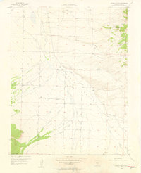
The Wet Mountain Valley defines this high-altitude cattle and sheep ranching landscape along the border of Custer and Huerfano counties. Surveyed in the early 1960s, the map reveals a remote pastoral economy dependent on scattered water sources such as the Hess Windmill, Oaks Windmill, and Rush Windmill. The most significant historical marker is the Bradford (Site) in the southern portion near Muddy Creek, indicating a formerly populated area or waypoint.
Find a feature on this map
38 named features on this map. Tap any name to fly to it.
Don’t see what you’re looking for? This feature index may not catch every label — zoom into the map to look around manually.
Map Details
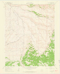
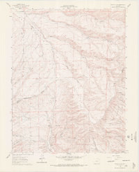
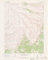
Editions of this 1960 Devils Gulch Map
4 editions found
Other maps of this area

1889 · Canon City
USGS Topo · 1:125,000

1889 · Huerfano Park
USGS Topo · 1:125,000

1892 · Huerfano Park
USGS Topo · 1:125,000

1892 · Canon City
USGS Topo · 1:125,000

1954 · Rosita
USGS Topo · 1:24,000

1954 · Trinidad
USGS Topo · 1:250,000

1954 · Pueblo
USGS Topo · 1:250,000

1955 · Trinidad
USGS Topo · 1:250,000

1957 · Pueblo
USGS Topo · 1:250,000
1957 · Aldrich Gulch
USGS Topo · 1:24,000