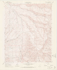
1960 Map of Devils Gulch
USGS Topo · Published 1972About this map
The Wet Mountain Valley floor and the surrounding high-altitude terrain define this 1960s survey of the Custer and Huerfano county line. The landscape is characterized by a network of ranching infrastructure and seasonal water sources essential for livestock in this arid environment. Named family landmarks like the Akin Ranch and Hess Windmill indicate a settled agricultural presence, while the Bradford (Site) near Bradford Creek points to a previous hub of activity now reduced to a historical marker.
Find a feature on this map
40 named features on this map. Tap any name to fly to it.
Don’t see what you’re looking for? This feature index may not catch every label — zoom into the map to look around manually.
Map Details
Editions of this 1960 Devils Gulch Map
4 editions found
Other maps of this area

1889 · Canon City
USGS Topo · 1:125,000

1889 · Huerfano Park
USGS Topo · 1:125,000

1892 · Huerfano Park
USGS Topo · 1:125,000

1892 · Canon City
USGS Topo · 1:125,000

1954 · Rosita
USGS Topo · 1:24,000

1954 · Trinidad
USGS Topo · 1:250,000

1954 · Pueblo
USGS Topo · 1:250,000

1955 · Trinidad
USGS Topo · 1:250,000

1957 · Pueblo
USGS Topo · 1:250,000

1957 · Aldrich Gulch
USGS Topo · 1:24,000