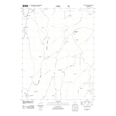
2011 Map of Devils Head
USGS Topo · Published 2011About this map
Devils Head and the surrounding Rampart Range define this high-altitude landscape south of Sprucewood. The area is a dense network of geological interests, evidenced by numerous specialized excavations including the California Lode Mine, the Cramer Pegmatite Mine, and the Devils Head Topaz Mine. Near the southern edge of the sheet, the Devils Head Lookout stands as a prominent landmark above the Devils Head Campground and the Colorado Mineral Society Mine. To the north, residential and community developments like Moonridge and the Shamballah-Ashrama occupy the drainages of Bear Creek and Middle Garber Creek. The map details a transition between wilderness recreation and small ranching operations such as Pineview Ranch and the B B L Ranch.
Find a feature on this map
62 named features on this map. Tap any name to fly to it.
Don’t see what you’re looking for? This feature index may not catch every label — zoom into the map to look around manually.
Map Details
Editions of this 2011 Devils Head Map
This is the sole edition of this map. No revisions or reprints were ever made.
Other maps of this area

1893 · Platte Canyon
USGS Topo · 1:125,000

1894 · Castle Rock
USGS Topo · 1:125,000

1913 · Castle Rock
USGS Topo · 1:125,000

1940 · Castle Rock
USGS Topo · 1:62,500

1945 · Castle Rock
USGS Topo · 1:62,500

1945 · Platte Canyon
USGS Topo · 1:24,000

1945 · Kassler
USGS Topo · 1:24,000

1948 · Kassler
USGS Topo · 1:24,000

1948 · Platte Canyon
USGS Topo · 1:24,000

1953 · Denver
USGS Topo · 1:250,000