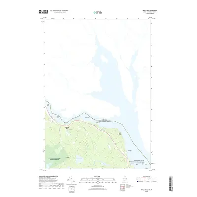
2018 Map of Devils Head
USGS Topo · Published 2018About this map
The St. Croix River serves as a natural boundary between the United States of America and Canada, carving a path through the timberlands and wetlands of Washington County. This survey highlights the complex shoreline where the river constricts at The Narrows before expanding past prominent landforms like Devils Head and Ford Point. The landscape is defined by the extensive Moosehorn National Wildlife Refuge, which protects varied habitats such as Carson Heath and Beaver Lake.
Find a feature on this map
26 named features on this map. Tap any name to fly to it.
Don’t see what you’re looking for? This feature index may not catch every label — zoom into the map to look around manually.
Map Details
Editions of this 2018 Devils Head Map
This is the sole edition of this map. No revisions or reprints were ever made.
Other maps of this area

1929 · Calais
USGS Topo · 1:48,000

1929 · Robbinston
USGS Topo · 1:48,000

1931 · Robbinston
USGS Topo · 1:62,500

1932 · Calais
USGS Topo · 1:62,500

1940 · Kellyland
USGS Topo · 1:62,500

1942 · Kellyland
USGS Topo · 1:62,500

1949 · Robbinston
USGS Topo · 1:24,000

1949 · Calais
USGS Topo · 1:24,000

1949 · Red Beach
USGS Topo · 1:24,000

1949 · Devils Head
USGS Topo · 1:24,000