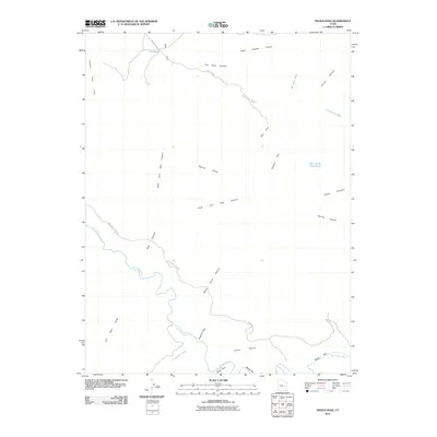
2011 Map of Devils Hole
USGS Topo · Published 2011About this map
The San Rafael River carves a winding path through this corner of Emery County, defining a landscape of deep canyons and expansive flats. In this arid environment, water is the primary architect, seen in the drainage patterns of the Black Box and the Lockhart Box which feed the main river corridor. Human activity is largely represented by grazing and resource exploration, with the San Rafael River Rd and Box Flat Rd providing the only primary access through the desert. Distinctive landmarks such as The Pack Saddle and the aptly named Devils Hole suggest a topography that challenged early travelers, while names like Moonshine Waterhole and Oil Well Draw hint at the specific history of water and mineral extraction in the San Rafael Swell area.
Find a feature on this map
26 named features on this map. Tap any name to fly to it.
Don’t see what you’re looking for? This feature index may not catch every label — zoom into the map to look around manually.
Map Details
Editions of this 2011 Devils Hole Map
This is the sole edition of this map. No revisions or reprints were ever made.
Other maps of this area

1885 · San Rafael
USGS Topo · 1:250,000

1886 · Price River
USGS Topo · 1:250,000

1896 · Price River
USGS Topo · 1:250,000

1953 · Red Plateau SE
USGS Topo · 1:24,000

1953 · Red Plateau SW
USGS Topo · 1:24,000

1953 · Beckwith Peak SW
USGS Topo · 1:24,000

1953 · Tidwell 2 NW
USGS Topo · 1:24,000

1954 · Stinking Spring Creek 1 NW
USGS Topo · 1:24,000

1954 · Stinking Spring Creek 1 NE
USGS Topo · 1:24,000

1954 · Tidwell Bottoms
USGS Topo · 1:62,500