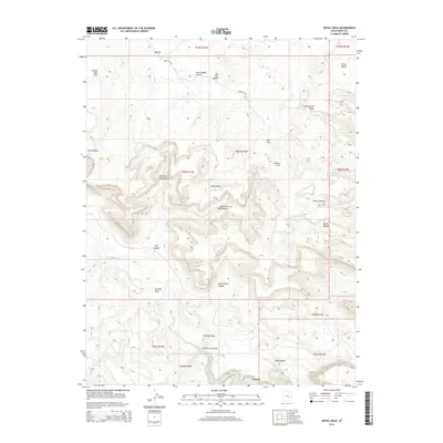
2014 Map of Devils Hole
USGS Topo · Published 2014About this map
San Rafael River snakes through the southern portion of this Emery County landscape, carving deep relief into the high desert terrain. The area is defined by a complex network of dry washes and named canyons, including the West Fork Red Canyon and the East Fork Red Canyon, which converge near the namesake Devils Hole. Historically, the land has been utilized for stock raising and resource exploration, evidenced by topographical landmarks like Horse Heaven, Jackass Flat, and Oil Well Draw. Human infrastructure is sparse, limited primarily to the unpaved Box Flat Rd which provides access to the interior flats. The presence of features such as Moonshine Waterhole highlights the critical importance of water sources in this arid environment, where drainage systems like Lockhart Wash and Big Hole Wash dominate the local geography.
Find a feature on this map
33 named features on this map. Tap any name to fly to it.
Don’t see what you’re looking for? This feature index may not catch every label — zoom into the map to look around manually.
Map Details
Editions of this 2014 Devils Hole Map
This is the sole edition of this map. No revisions or reprints were ever made.
Other maps of this area

1885 · San Rafael
USGS Topo · 1:250,000

1886 · Price River
USGS Topo · 1:250,000

1896 · Price River
USGS Topo · 1:250,000

1953 · Red Plateau SE
USGS Topo · 1:24,000

1953 · Red Plateau SW
USGS Topo · 1:24,000

1953 · Beckwith Peak SW
USGS Topo · 1:24,000

1953 · Tidwell 2 NW
USGS Topo · 1:24,000

1954 · Stinking Spring Creek 1 NW
USGS Topo · 1:24,000

1954 · Stinking Spring Creek 1 NE
USGS Topo · 1:24,000

1954 · Tidwell Bottoms
USGS Topo · 1:62,500