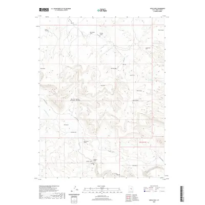
2020 Map of Devils Hole
USGS Topo · Published 2020About this map
The San Rafael River carves through the heart of this landscape, its path defined by dramatic topographical shifts and deep incisions into the plateau. The terrain is a complex network of canyons and flats, where names like Devils Hole and Black Box suggest the challenging nature of the local geography. Ranching and travel history are encoded in the place names, from Horse Heaven to Jackass Flat, and the essential search for water in this arid environment is evident at Moonshine Waterhole and Dry Pond.
Find a feature on this map
30 named features on this map. Tap any name to fly to it.
Don’t see what you’re looking for? This feature index may not catch every label — zoom into the map to look around manually.
Map Details
Editions of this 2020 Devils Hole Map
This is the sole edition of this map. No revisions or reprints were ever made.
Other maps of this area

1885 · San Rafael
USGS Topo · 1:250,000

1886 · Price River
USGS Topo · 1:250,000

1896 · Price River
USGS Topo · 1:250,000

1953 · Red Plateau SE
USGS Topo · 1:24,000

1953 · Red Plateau SW
USGS Topo · 1:24,000

1953 · Beckwith Peak SW
USGS Topo · 1:24,000

1953 · Tidwell 2 NW
USGS Topo · 1:24,000

1954 · Stinking Spring Creek 1 NW
USGS Topo · 1:24,000

1954 · Stinking Spring Creek 1 NE
USGS Topo · 1:24,000

1954 · Tidwell Bottoms
USGS Topo · 1:62,500