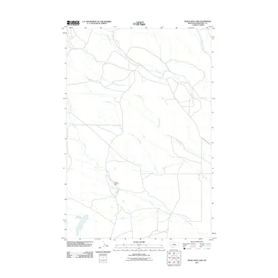
2011 Map of Devils Hole Lake
USGS Topo · Published 2011About this map
Devils Hole Lake anchors the southern portion of this landscape in Musselshell County, where the topography is defined by an intricate network of seasonal and perennial watercourses. The drainage patterns of Willow Creek, Minerva Creek, and Whoop-Up Creek illustrate the hydrologic character of the region, while the Snowy Mountain Dam on Pole Creek represents the 21st-century water management infrastructure in this arid part of Montana.
Find a feature on this map
8 named features on this map. Tap any name to fly to it.
Don’t see what you’re looking for? This feature index may not catch every label — zoom into the map to look around manually.
Map Details
Editions of this 2011 Devils Hole Lake Map
This is the sole edition of this map. No revisions or reprints were ever made.
Other maps of this area

1889 · Big Snowy Mountain
USGS Topo · 1:250,000

1893 · Big Snowy Mountain
USGS Topo · 1:250,000

1954 · Roundup
USGS Topo · 1:250,000

1958 · Roundup
USGS Topo · 1:250,000

1970 · South Bench
USGS Topo · 1:24,000

1986 · Tyler
USGS Topo · 1:24,000

1986 · Devils Hole Lake
USGS Topo · 1:24,000

1986 · Pender Coulee
USGS Topo · 1:24,000

1986 · Emory School
USGS Topo · 1:24,000
1986 · Timber Buttes North
USGS Topo · 1:24,000