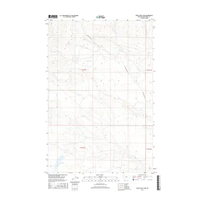
2017 Map of Devils Hole Lake
USGS Topo · Published 2017About this map
Devils Hole Lake anchors the southwestern corner of this landscape in central Montana, where high-altitude drainage patterns define the territory. The terrain is deeply incised by a network of seasonal and perennial streams, most notably the winding course of Minerva Cr and Willow Cr. These waterways, along with the descriptively named Whoop-Up Cr and Spring Cr, reflect the hydrological character of the Big Snowy Mountains foothills. Transportation through this remote section of Musselshell County is limited to a few established routes like Snowy Mountain Rd and Rd 271, which follow the natural contours of the ridges and valleys. The map provides a clear view of the Public Land Survey System grid, including boundaries for townships such as t11n r22e and t10n r23e, essential for property research and land use history in this sparsely settled region.
Find a feature on this map
13 named features on this map. Tap any name to fly to it.
Don’t see what you’re looking for? This feature index may not catch every label — zoom into the map to look around manually.
Map Details
Editions of this 2017 Devils Hole Lake Map
This is the sole edition of this map. No revisions or reprints were ever made.
Other maps of this area

1889 · Big Snowy Mountain
USGS Topo · 1:250,000

1893 · Big Snowy Mountain
USGS Topo · 1:250,000

1954 · Roundup
USGS Topo · 1:250,000

1958 · Roundup
USGS Topo · 1:250,000

1970 · South Bench
USGS Topo · 1:24,000

1986 · Tyler
USGS Topo · 1:24,000

1986 · Devils Hole Lake
USGS Topo · 1:24,000

1986 · Pender Coulee
USGS Topo · 1:24,000

1986 · Emory School
USGS Topo · 1:24,000
1986 · Timber Buttes North
USGS Topo · 1:24,000