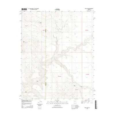
2014 Map of Devils Hump
USGS Topo · Published 2014About this map
Devils Hump rises above the transition between the high plateaus and the deep drainages of northwestern Arizona, marking a landscape defined by seasonal water sources and ranching infrastructure. This 2014 survey documents the complex topography where the Mohave and Yavapai county lines meet amidst a series of notable landforms like Indian Head and Panther Point. The map provides a modern record of local nomenclature, featuring numerous water tanks and wells that suggest a history of livestock management in this arid environment, including Butch Nichols Tank, Jean Entz Tank, and the pragmatically named Last Minute Well. Drainage patterns are captured in detail through the branching systems of Trout Cr and Fork Rock Cr, which carve through deep features such as Mohon Canyon and Ledge Canyon. These canyons, including the uniquely named Sewer Canyon, create a rugged network of draws and basins like Palomino Draw and Cedar Basin that have long shaped navigation and land use in this part of the Southwest.
Find a feature on this map
28 named features on this map. Tap any name to fly to it.
Don’t see what you’re looking for? This feature index may not catch every label — zoom into the map to look around manually.
Map Details
Editions of this 2014 Devils Hump Map
This is the sole edition of this map. No revisions or reprints were ever made.
Other maps of this area

1886 · Diamond Creek
USGS Topo · 1:250,000

1892 · Diamond Creek
USGS Topo · 1:250,000

1923 · Signal
USGS Topo · 1:250,000

1942 · Signal
USGS Topo · 1:250,000

1948 · Williams
USGS Topo · 1:250,000

1950 · Prescott
USGS Topo · 1:250,000

1954 · Prescott
USGS Topo · 1:250,000

1954 · Williams
USGS Topo · 1:250,000

1956 · Williams
USGS Topo · 1:250,000

1958 · Prescott
USGS Topo · 1:250,000