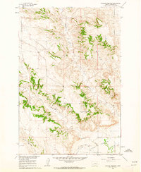
1979 Map of Devils Kitchen
USGS Topo · Published 1980About this map
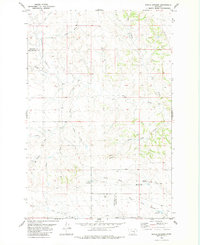
Devils Kitchen defines the center of this 1970s landscape, where the high plains of the Treasure and Yellowstone county line are carved by a complex network of seasonal drainages. The area is characterized by its hydrological features, particularly the various coulees like Rough Coulee, Sand Coulee, and Winter Camp Coulee that feed into larger systems such as Alkali Creek. The distribution of water management sites is a primary indicator of the land's utility, with several named landmarks such as Larsens Reservoirs, Horton Reservoir, and Teds Reservoir scattered across the township lines. This pattern of small-scale reservoirs and named forks, including the North Fork and Middle Fork Edwards Creek, reflects the ranching and agricultural requirements of this eastern Montana region during the late twentieth century.
Find a feature on this map
20 named features on this map. Tap any name to fly to it.
Don’t see what you’re looking for? This feature index may not catch every label — zoom into the map to look around manually.
Map Details
Editions of this 1979 Devils Kitchen Map
This is the sole edition of this map. No revisions or reprints were ever made.
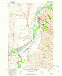
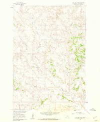
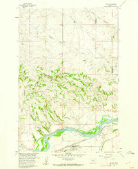
Other maps of this area

1954 · Forsyth
USGS Topo · 1:250,000

1957 · Forsyth
USGS Topo · 1:250,000

1958 · Forsyth
USGS Topo · 1:250,000
1960 · Bighorn
USGS Topo · 1:24,000
1960 · Coal Bank Creek
USGS Topo · 1:24,000
1960 · Custer
USGS Topo · 1:24,000
1960 · Rancher Cemetery
USGS Topo · 1:24,000
1960 · Mc Konkey Creek
USGS Topo · 1:24,000
1979 · Hysham
USGS Topo · 1:100,000
1980 · Weed Creek East
USGS Topo · 1:24,000