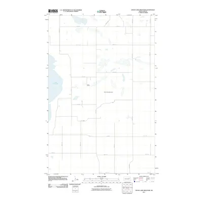
2011 Map of Devils Lake Mountain
USGS Topo · Published 2011About this map
East Devils Lake dominates the western edge of this prairie landscape, where the shoreline meets a highly structured grid of section roads. The terrain is defined by the prominent rise of Devils Lake Mountain, a distinctive landform in a region otherwise characterized by scattered wetlands and small potholes. In the heart of the Wood Lake District, the Odessa Cemetery serves as a quiet marker of early settlement history, located just east of E Lake Rd. The map illustrates a rural North Dakota environment where the transition between aquatic basins and upland plains is navigated by a precise network of routes like Pare Rd and 32nd St NE, reflecting a late 20th-century agricultural and topographic layout that remains largely unchanged by major urban development.
Find a feature on this map
21 named features on this map. Tap any name to fly to it.
Don’t see what you’re looking for? This feature index may not catch every label — zoom into the map to look around manually.
Map Details
Editions of this 2011 Devils Lake Mountain Map
This is the sole edition of this map. No revisions or reprints were ever made.
Other maps of this area

1930 · Pekin
USGS Topo · 1:62,500

1930 · Hamar
USGS Topo · 1:62,500

1950 · Devils Lake Mountain
USGS Topo · 1:24,000

1951 · Crary
USGS Topo · 1:24,000

1951 · Devils Lake Mountain
USGS Topo · 1:24,000

1951 · Pekin NW
USGS Topo · 1:24,000

1951 · Free Peoples Lake
USGS Topo · 1:24,000

1951 · Tolna
USGS Topo · 1:24,000

1951 · Pekin
USGS Topo · 1:62,500

1952 · New Rockford
USGS Topo · 1:250,000