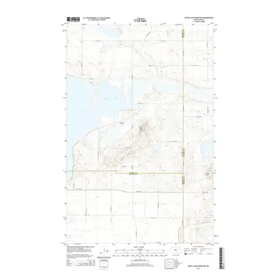
2014 Map of Devils Lake Mountain
USGS Topo · Published 2014About this map
Devils Lake Mtn and Blue Mtn dominate the undulating terrain of this landscape where three North Dakota counties—Ramsey, Benson, and Nelson—all meet. The eastern reaches of E Devils Lake and the northern tip of Stump Lake define the hydrology of the area, reflecting the fluctuating water levels common to this closed-basin region. Near the center of the sheet, the Odessa Cem serves as a small but vital landmark for genealogists and local historians, representing the enduring legacy of the rural communities that settled these plains. A grid of county roads, including Co Road 4 and Co Road 15, provides access through the expansive agricultural and prairie lands, while E Lake Rd skirts the edge of the prominent shoreline.
Find a feature on this map
27 named features on this map. Tap any name to fly to it.
Don’t see what you’re looking for? This feature index may not catch every label — zoom into the map to look around manually.
Map Details
Editions of this 2014 Devils Lake Mountain Map
This is the sole edition of this map. No revisions or reprints were ever made.
Other maps of this area

1930 · Pekin
USGS Topo · 1:62,500

1930 · Hamar
USGS Topo · 1:62,500

1950 · Devils Lake Mountain
USGS Topo · 1:24,000

1951 · Crary
USGS Topo · 1:24,000

1951 · Devils Lake Mountain
USGS Topo · 1:24,000

1951 · Pekin NW
USGS Topo · 1:24,000

1951 · Free Peoples Lake
USGS Topo · 1:24,000

1951 · Tolna
USGS Topo · 1:24,000

1951 · Pekin
USGS Topo · 1:62,500

1952 · New Rockford
USGS Topo · 1:250,000