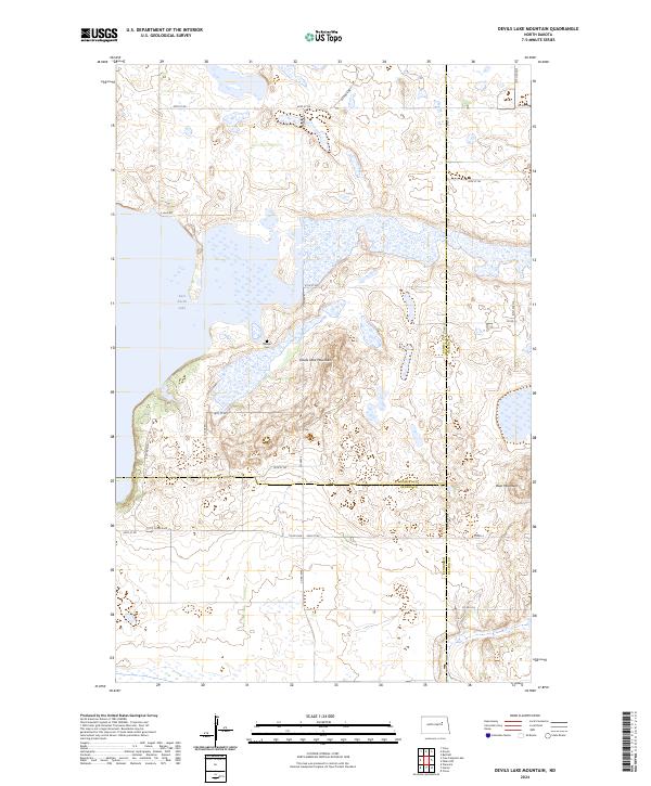
2024 Map of Devils Lake Mountain
USGS Topo · Published 2024About this map
East Devils Lake dominates the western edge of this landscape, its fluctuating shoreline defining the transition from open water to the prairie wetlands of the Ramsey County Waterfowl Production Area. The topography is marked by several significant rises, most notably Devils Lake Mountain and Blue Mountain further to the southeast. These elevations provide a striking contrast to the surrounding section lines and agricultural drainage patterns typical of North Dakota's glacial till plains.
Find a feature on this map
31 named features on this map. Tap any name to fly to it.
Don’t see what you’re looking for? This feature index may not catch every label — zoom into the map to look around manually.
Map Details
Editions of this 2024 Devils Lake Mountain Map
This is the sole edition of this map. No revisions or reprints were ever made.
Other maps of this area

1930 · Pekin
USGS Topo · 1:62,500

1930 · Hamar
USGS Topo · 1:62,500

1950 · Devils Lake Mountain
USGS Topo · 1:24,000

1951 · Crary
USGS Topo · 1:24,000

1951 · Devils Lake Mountain
USGS Topo · 1:24,000

1951 · Pekin NW
USGS Topo · 1:24,000

1951 · Free Peoples Lake
USGS Topo · 1:24,000

1951 · Tolna
USGS Topo · 1:24,000

1951 · Pekin
USGS Topo · 1:62,500

1952 · New Rockford
USGS Topo · 1:250,000