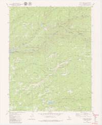
1979 Map of Devils Nose
USGS Topo · Published 1979About this map
The North Fork Mokelumne River carves a deep canyon through the center of this terrain, serving as the border between Amador and Calaveras counties. During the late 1970s, the landscape was defined by complex hydroelectric infrastructure, including the Powerhouse, Tiger Creek Reservoir, and the Tiger Creek Forbay. High-elevation features like Cooks Station Ridge and Oaks Ridge dominate the northern section, while the southern portion transitions toward Bailey Ridge. The map details a network of utility management and recreation within the Eldorado National Forest and Stanislaus National Forest. Researchers can find small, localized settlements such as Hunter Flat and Boston Flat, alongside remote landmarks like Bruce Crossing and Whitmore Meadow.
Find a feature on this map
39 named features on this map. Tap any name to fly to it.
Don’t see what you’re looking for? This feature index may not catch every label — zoom into the map to look around manually.
Map Details
Editions of this 1979 Devils Nose Map
3 editions found
Other maps of this area

1889 · Jackson
USGS Topo · 1:125,000

1889 · Pyramid Peak
USGS Topo · 1:125,000

1891 · Big Trees
USGS Topo · 1:125,000

1891 · Placerville
USGS Topo · 1:125,000

1891 · Pyramid Peak
USGS Topo · 1:125,000

1892 · Jackson
USGS Topo · 1:125,000

1892 · Placerville
USGS Topo · 1:125,000

1893 · Placerville
USGS Topo · 1:125,000

1894 · Big Trees
USGS Topo · 1:125,000

1895 · Pyramid Peak
USGS Topo · 1:125,000