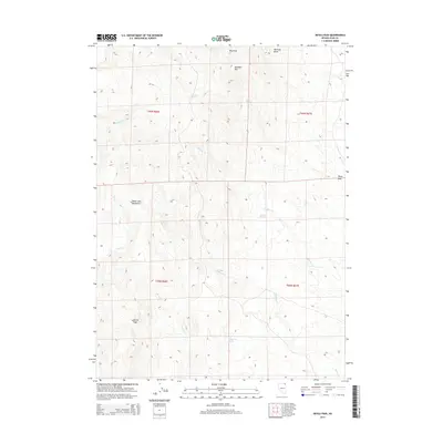
2015 Map of Devils Pass
USGS Topo · Published 2015About this map
Devils Pass and the Toana John Mountains dominate this high-desert landscape in northeastern Nevada. The region is defined by a series of drainages and intermittent water sources, such as Moonshine Spring, Boulder Spring, and Crocket Spring, which historically sustained travel and ranching through these arid corridors. The map reveals a complex system of draws and creeks, including Big Draw and Mustang Draw, that cut through the high elevations of Gollaher Mtn. Waterways like Willow Cr, Trout Cr, and Badger Cr provide a detailed look at the watershed patterns of this portion of Elko County. The isolated landmark of Tepee Rock stands out as a distinctive natural feature in the eastern section of the survey, offering a clear reference point for those studying the physical geography or historical cattle-trailing routes of this remote basin-and-range territory.
Find a feature on this map
20 named features on this map. Tap any name to fly to it.
Don’t see what you’re looking for? This feature index may not catch every label — zoom into the map to look around manually.
Map Details
Editions of this 2015 Devils Pass Map
This is the sole edition of this map. No revisions or reprints were ever made.
Other maps of this area

1955 · Wells
USGS Topo · 1:250,000

1957 · Delaplain
USGS Topo · 1:62,500

1958 · Wells
USGS Topo · 1:250,000

1961 · Wells
USGS Topo · 1:250,000

1961 · Delano Mountains
USGS Topo · 1:62,500

1961 · Gollaher Mountain
USGS Topo · 1:62,500

1968 · Texas Spring
USGS Topo · 1:24,000
1980 · Dry Canyon
USGS Topo · 1:24,000

1982 · Jackpot
USGS Topo · 1:100,000
1989 · Stratton Spring
USGS Topo · 1:24,000