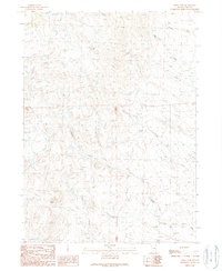
1989 Map of Devils Pass
USGS Topo · Published 1989About this map
Devils Pass serves as a central landmark in this high-desert landscape of Elko County, where the topography is defined by a dense network of seasonal drainages and vital water sources. The map, based on photography from the mid-1980s, reveals a territory where survival and navigation depended heavily on named water points such as Moonshine Spring, Crocker Spring, and Elrod Spring. These isolated springs provide the only breaks in a dry terrain carved by Badger Creek and Big Boulder Creek.
Find a feature on this map
14 named features on this map. Tap any name to fly to it.
Don’t see what you’re looking for? This feature index may not catch every label — zoom into the map to look around manually.
Map Details
Editions of this 1989 Devils Pass Map
This is the sole edition of this map. No revisions or reprints were ever made.
Other maps of this area

1955 · Wells
USGS Topo · 1:250,000

1957 · Delaplain
USGS Topo · 1:62,500

1958 · Wells
USGS Topo · 1:250,000

1961 · Wells
USGS Topo · 1:250,000

1961 · Delano Mountains
USGS Topo · 1:62,500

1961 · Gollaher Mountain
USGS Topo · 1:62,500

1968 · Texas Spring
USGS Topo · 1:24,000
1980 · Dry Canyon
USGS Topo · 1:24,000

1982 · Jackpot
USGS Topo · 1:100,000
1989 · Stratton Spring
USGS Topo · 1:24,000