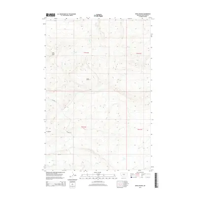
2014 Map of Devils Pocket
USGS Topo · Published 2014About this map
Devils Pocket characterizes this high-plains landscape of central Montana, where dramatic elevation changes define the topography of Wheatland County. The area is dominated by the prominent Wild Horse Butte and the winding course of Timber Cr, which drains south toward the expansive Devils Pocket basin. Human presence is marked by the small settlement at The Madison, which sits near the junction of rural routes like Red Bridge Rd.
Find a feature on this map
12 named features on this map. Tap any name to fly to it.
Don’t see what you’re looking for? This feature index may not catch every label — zoom into the map to look around manually.
Map Details
Editions of this 2014 Devils Pocket Map
This is the sole edition of this map. No revisions or reprints were ever made.
Other maps of this area

1889 · Big Snowy Mountain
USGS Topo · 1:250,000

1893 · Big Snowy Mountain
USGS Topo · 1:250,000

1954 · Roundup
USGS Topo · 1:250,000

1958 · Roundup
USGS Topo · 1:250,000

1985 · Jim Creek
USGS Topo · 1:24,000
1985 · Gougley Creek
USGS Topo · 1:24,000

1985 · Progress
USGS Topo · 1:24,000
1986 · Ten O'Clock Gate
USGS Topo · 1:24,000

1986 · Shawmut
USGS Topo · 1:24,000
1986 · Devils Pocket
USGS Topo · 1:24,000