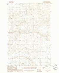
1986 Map of Devils Pocket
USGS Topo · Published 1986About this map
Wild Horse Butte rises above the dramatic landscape of Wheatland County, where the intricate drainage systems of the Musselshell River basin define the topography. This 1986 survey documents a stretch of Montana range land where natural water sources like Mud Creek, Fish Creek, and several Springs dictate the patterns of land use and navigation. The namesake Devils Pocket represents a distinct geologic depression or basin within the high plains, providing a look at the area's physical geography before modern intensive development. To the southwest, a prominent formation known as The Madison stands as a landmark for local ranchers and land surveyors, illustrating the characteristic limestone or sedimentary features that define this part of the central Montana benchlands.
Find a feature on this map
8 named features on this map. Tap any name to fly to it.
Don’t see what you’re looking for? This feature index may not catch every label — zoom into the map to look around manually.
Map Details
Editions of this 1986 Devils Pocket Map
This is the sole edition of this map. No revisions or reprints were ever made.
Other maps of this area

1889 · Big Snowy Mountain
USGS Topo · 1:250,000

1893 · Big Snowy Mountain
USGS Topo · 1:250,000

1954 · Roundup
USGS Topo · 1:250,000

1958 · Roundup
USGS Topo · 1:250,000

1985 · Jim Creek
USGS Topo · 1:24,000
1985 · Gougley Creek
USGS Topo · 1:24,000

1985 · Progress
USGS Topo · 1:24,000
1986 · Ten O'Clock Gate
USGS Topo · 1:24,000

1986 · Shawmut
USGS Topo · 1:24,000
1986 · Harlowton
USGS Topo · 1:24,000