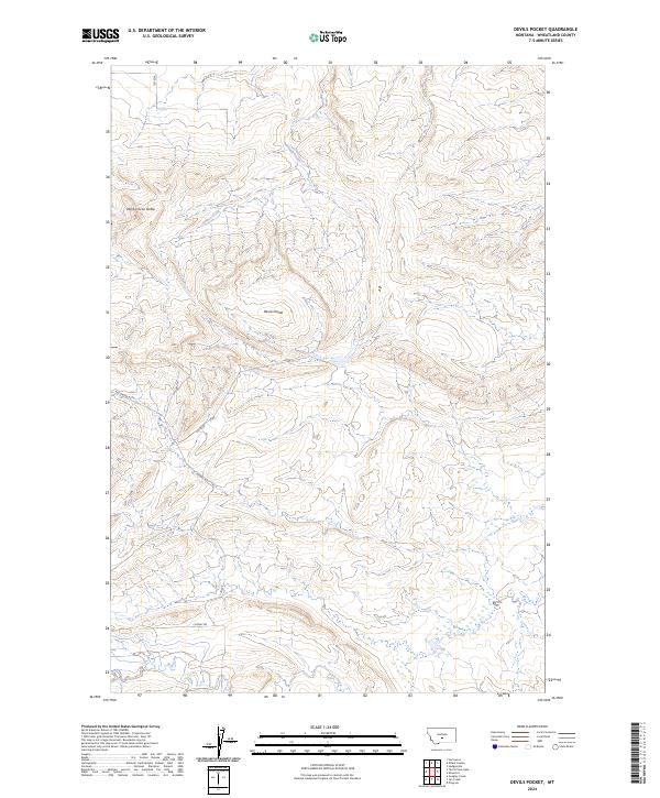
2024 Map of Devils Pocket
USGS Topo · Published 2024About this map
Devils Pocket defines the central topography of this Wheatland County landscape, where the high point of Wild Horse Butte overlooks a drainage network shaped by Timber Creek and Fish Creek. The land is segmented by the Public Land Survey System, as indicated by the township and range lines of t7n r16e and t6n r16e. Transportation through this open terrain is provided by a small network of named thoroughfares including Red Bridge Rd, Cooney Rd, and Jp Rd, which connect the isolated ranching and grazing areas of central Montana. This contemporary survey by the U.S. Geological Survey captures the modern character of these drainages and buttes, providing clear detail on the elevation changes and seasonal watercourses that dictate the use of this rural territory.
Find a feature on this map
11 named features on this map. Tap any name to fly to it.
Don’t see what you’re looking for? This feature index may not catch every label — zoom into the map to look around manually.
Map Details
Editions of this 2024 Devils Pocket Map
This is the sole edition of this map. No revisions or reprints were ever made.
Other maps of this area

1889 · Big Snowy Mountain
USGS Topo · 1:250,000

1893 · Big Snowy Mountain
USGS Topo · 1:250,000

1954 · Roundup
USGS Topo · 1:250,000

1958 · Roundup
USGS Topo · 1:250,000

1985 · Jim Creek
USGS Topo · 1:24,000
1985 · Gougley Creek
USGS Topo · 1:24,000

1985 · Progress
USGS Topo · 1:24,000
1986 · Ten O'Clock Gate
USGS Topo · 1:24,000

1986 · Shawmut
USGS Topo · 1:24,000
1986 · Devils Pocket
USGS Topo · 1:24,000