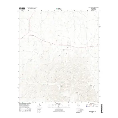
2016 Map of Devils Sinkhole
USGS Topo · Published 2016About this map
Devils Sinkhole defines the central focus of this Edwards County landscape, marking one of the most significant natural features in this part of Texas. The surrounding terrain is heavily dissected by numerous drainage systems, including Guthrie Draw and Steve Kemp Draw, which channel water through the limestone plateaus toward lower elevations. These geographic depressions are often named after local families or historical events, as seen with Cade Hollow, Deadman Hollow, and Thurman Hollow. Settlement is sparse, with the primary transport corridor being Kerrville Rd, which cuts across the northern half of the quadrangle. Water sources such as Hackberry Springs and the seasonal flows of Hackberry Cr and Deer Cr were likely vital for early ranching operations in this arid environment, where landmarks like Cedar Knob served as essential navigational points.
Find a feature on this map
19 named features on this map. Tap any name to fly to it.
Don’t see what you’re looking for? This feature index may not catch every label — zoom into the map to look around manually.
Map Details
Editions of this 2016 Devils Sinkhole Map
This is the sole edition of this map. No revisions or reprints were ever made.
Other maps of this area

1893 · Rock Springs
USGS Topo · 1:125,000

1893 · Nueces
USGS Topo · 1:125,000

1896 · Nueces
USGS Topo · 1:125,000

1947 · Hackberry
USGS Topo · 1:62,500

1954 · Llano
USGS Topo · 1:250,000

1954 · San Antonio
USGS Topo · 1:250,000

1954 · Sonora
USGS Topo · 1:250,000

1955 · Llano
USGS Topo · 1:250,000

1956 · Llano
USGS Topo · 1:250,000

1957 · San Antonio
USGS Topo · 1:250,000