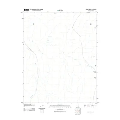
2012 Map of Devils Throat
USGS Topo · Published 2012About this map
Devils Throat anchors this arid Nevada landscape, where water sources like Red Rock Springs and Hartman Tank reveal the essential geography of the high desert. The 2012 survey illustrates a terrain defined by dramatic ridges and basins, including Bitter Ridge and the Wechech Basin. Transportation through this remote section of Clark County relies on the paths of Gold Butte Wash Rd and New Gold Butte Rd, which follow the natural drainage patterns of the Gold Butte Wash. To the east, the landscape transitions through the Saint Thomas Gap near the Mud Hills, showing how topography dictates movement in this part of the Virgin Mountains region. Researchers can trace the network of seasonal washes such as Mud Wash and Pussy Willow Wash that intersect the desert floor.
Find a feature on this map
16 named features on this map. Tap any name to fly to it.
Don’t see what you’re looking for? This feature index may not catch every label — zoom into the map to look around manually.
Map Details
Editions of this 2012 Devils Throat Map
This is the sole edition of this map. No revisions or reprints were ever made.
Other maps of this area

1886 · Saint Thomas
USGS Topo · 1:250,000

1893 · Saint Thomas
USGS Topo · 1:250,000

1926 · Bonelli
USGS Topo · 1:96,000

1953 · Overton Beach
USGS Topo · 1:62,500

1953 · Gold Butte
USGS Topo · 1:62,500

1954 · Las Vegas
USGS Topo · 1:250,000

1957 · Las Vegas
USGS Topo · 1:250,000

1958 · Virgin Peak
USGS Topo · 1:62,500

1958 · Overton
USGS Topo · 1:62,500

1959 · Las Vegas
USGS Topo · 1:250,000