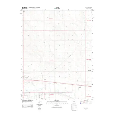
2013 Map of Devine
USGS Topo · Published 2013About this map
Baxter, Devine, and Nyberg anchor this landscape east of Pueblo, marking a transition from industrial aviation infrastructure to the irrigated agricultural lands of the Arkansas River valley. The Pueblo Memorial Airport occupies the western edge of the quadrangle, with its modern grid of Keeler Pkwy and Excellence Ave contrasting sharply with the rural tracks further east. Water management defines the southern half of the map, where the Booth Canal and Excelsior Ditch divert water across the plains to support local farming. The natural drainage of the Saint Charles River meanders through the southern border, while several seasonal watercourses like Andy Cr and Chico Cr cut through the northern range. For researchers, the map traces the intersection of historic irrigation networks and the mid-century expansion of local transportation routes such as Dot Test Rd and Nyberg Rd.
Find a feature on this map
34 named features on this map. Tap any name to fly to it.
Don’t see what you’re looking for? This feature index may not catch every label — zoom into the map to look around manually.
Map Details
Editions of this 2013 Devine Map
This is the sole edition of this map. No revisions or reprints were ever made.
Other maps of this area

1891 · Pueblo
USGS Topo · 1:125,000

1891 · Nepesta
USGS Topo · 1:125,000

1893 · Nepesta
USGS Topo · 1:125,000

1894 · Pueblo
USGS Topo · 1:125,000

1896 · Pueblo
USGS Topo · 1:125,000

1897 · Pueblo
USGS Topo · 1:125,000

1904 · Nepesta
USGS Topo · 1:125,000

1954 · Pueblo
USGS Topo · 1:250,000

1957 · Pueblo
USGS Topo · 1:250,000

1958 · Pueblo
USGS Topo · 1:250,000