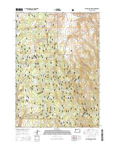
2014 Map of Devine Ridge North
USGS Topo · Published 2014About this map
Malhuer National Forest encompasses the high-desert terrain of Harney County shown here in the mid-2010s. The landscape is defined by the sharp transition between creek drainages and high ridges, notably Devine Ridge and Trout Creek Ridge. Settlement is sparse, with the primary human footprint represented by Williams Field and a network of Forest Service roads including Devine Ridge Rd and the John Day-Burns Hwy. Numerous springs, such as Larsen Spring, Strawberry Spring, and Roach Creek Spring, serve as critical water points in this arid environment. The map details complex drainage patterns where Poison Cr and Marshall Cr carve through the plateau toward Devine Canyon, illustrating the importance of local topography to the region's management and access.
Find a feature on this map
62 named features on this map. Tap any name to fly to it.
Don’t see what you’re looking for? This feature index may not catch every label — zoom into the map to look around manually.
Map Details
Editions of this 2014 Devine Ridge North Map
This is the sole edition of this map. No revisions or reprints were ever made.
Other maps of this area

1955 · Burns
USGS Topo · 1:250,000

1958 · Burns
USGS Topo · 1:250,000

1959 · Burns
USGS Topo · 1:250,000

1959 · West Myrtle Butte
USGS Topo · 1:62,500

1959 · Harney
USGS Topo · 1:62,500

1960 · Burns
USGS Topo · 1:62,500

1961 · Calamity Butte
USGS Topo · 1:62,500

1978 · Stinkingwater Mountains
USGS Topo · 1:100,000
1990 · Poison Creek
USGS Topo · 1:24,000
1990 · Calamity Butte
USGS Topo · 1:24,000