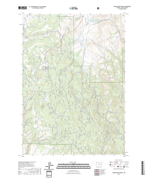
2023 Map of Devine Ridge North
USGS Topo · Published 2023About this map
Malheur National Forest dominates this section of the High Desert, where the rugged topography of Harney County is defined by steep drainages and isolated springs. The landscape transition from the high point at Gobblers Knob down into Devine Canyon illustrates the complex hydrology of the region, featuring an extensive network of seasonal and perennial water sources including Strawberry Creek and Roach Creek. Settled openings like Williams Field and Crow Flat suggest historical grazing or agricultural use amidst the timbered ridges. Genealogists and local historians can trace family names through landmarks like Van Zandt Meadows and numerous water points such as Larsen Spring and Abraham Spring. The map also details the narrow canyons of Theimer Canyon and the prominent volcanic spine of Devine Ridge, providing a clear record of the area's natural boundaries and remote water access points.
Find a feature on this map
47 named features on this map. Tap any name to fly to it.
Don’t see what you’re looking for? This feature index may not catch every label — zoom into the map to look around manually.
Map Details
Editions of this 2023 Devine Ridge North Map
This is the sole edition of this map. No revisions or reprints were ever made.
Other maps of this area

1955 · Burns
USGS Topo · 1:250,000

1958 · Burns
USGS Topo · 1:250,000

1959 · Burns
USGS Topo · 1:250,000

1959 · West Myrtle Butte
USGS Topo · 1:62,500

1959 · Harney
USGS Topo · 1:62,500

1960 · Burns
USGS Topo · 1:62,500

1961 · Calamity Butte
USGS Topo · 1:62,500

1978 · Stinkingwater Mountains
USGS Topo · 1:100,000
1990 · Poison Creek
USGS Topo · 1:24,000
1990 · Calamity Butte
USGS Topo · 1:24,000