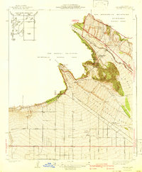
1941 Map of Devore
USGS Topo · Published 1941About this map
Atchison Topeka and Santa Fe and Union Pacific rails dominate the landscape where the San Gabriel Mountains and San Bernardino Mountains meet. This survey, completed in the late 1930s, reveals a complex water management and industrial infrastructure designed to harness the drainage of Lytle Creek. The presence of the Lytle Creek Water Spreading Area, multiple numbered weirs, and the Fontana Power Plant indicates the critical role of water conservation and power generation for the developing valley below. Near the settlement of Devore, local landmarks such as the Cajon Sch and the Glenn Helen Infirmary appear alongside transportation corridors like Cajon Blvd and Kendall Drive. The map also captures early aviation history with the Fontana Airport and its associated Beacon, positioned just north of the grid-patterned agricultural and residential expansion along Highland Avenue.
Find a feature on this map
40 named features on this map. Tap any name to fly to it.
Don’t see what you’re looking for? This feature index may not catch every label — zoom into the map to look around manually.
Map Details
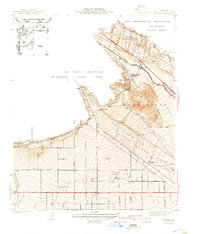
Editions of this 1941 Devore Map
2 editions found
Other maps of this area

1896 · San Bernardino
USGS Topo · 1:62,500

1897 · Cucamonga
USGS Topo · 1:62,500

1898 · San Bernardino
USGS Topo · 1:62,500

1900 · Cucamonga
USGS Topo · 1:62,500

1901 · Southern California Sheet No. 1
USGS Topo · 1:250,000

1901 · San Bernardino
USGS Topo · 1:62,500

1902 · Hesperia
USGS Topo · 1:62,500

1903 · Cucamonga
USGS Topo · 1:62,500

1903 · San Antonio
USGS Topo · 1:62,500

1904 · Southern California Sheet No. 1
USGS Topo · 1:250,000