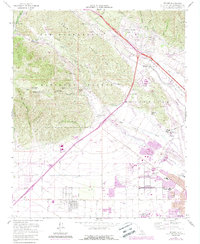
1966 Map of Devore
USGS Topo · Published 1988About this map
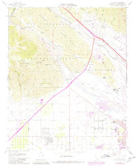
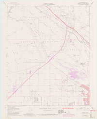
Lytle Creek and the Cajon Wash converge in this mid-century survey of the San Bernardino foothills, showing a landscape defined by the transition from the San Bernardino National Forest to expanding suburban and industrial development. The area around Devore and Devore Heights reflects the growing influence of transportation, with the Barstow Freeway and the Santa Fe RR cutting through the canyon pass. The southern portion of the map reveals a shift toward civic and aviation utility, featuring the Gilfillan Airport and the Rialto Municipal Airport (Miro Field). Notable local landmarks include the Verdemont Ranch and the Glen Helen Rehabilitation Facility, alongside recreational spaces like Glen Helen Regional Park. The presence of several Gravel Pits and the Fish Hatchery near the mouth of the canyon underscores the region's diverse land use as it moved into the late 1960s.
Find a feature on this map
44 named features on this map. Tap any name to fly to it.
Don’t see what you’re looking for? This feature index may not catch every label — zoom into the map to look around manually.
Map Details
Editions of this 1966 Devore Map
6 editions found
Other maps of this area

1896 · San Bernardino
USGS Topo · 1:62,500

1897 · Cucamonga
USGS Topo · 1:62,500

1898 · San Bernardino
USGS Topo · 1:62,500

1900 · Cucamonga
USGS Topo · 1:62,500

1901 · Southern California Sheet No. 1
USGS Topo · 1:250,000

1901 · San Bernardino
USGS Topo · 1:62,500

1902 · Hesperia
USGS Topo · 1:62,500

1903 · Cucamonga
USGS Topo · 1:62,500

1903 · San Antonio
USGS Topo · 1:62,500

1904 · Southern California Sheet No. 1
USGS Topo · 1:250,000