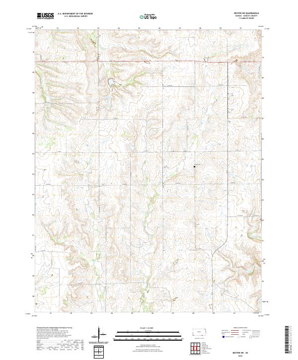
2022 Map of Dexter SW
USGS Topo · Published 2022About this map
Patton Cem sits near the headwaters of Beaver Cr, serving as a central landmark in this portion of Cowley County. The landscape is defined by an intricate network of drainage ways, including Rock Cr, Wildcat Cr, and Spring Cr, which carve through the terrain. The presence of numerous numbered section roads like 292nd Rd and 312th Rd reflects a long-established rural grid system, connecting isolated farmsteads across the township boundaries of t34s r7e and t35s r7e. Small tributaries such as Little Crabb Cr and Donahue Cr further delineate the local hydrology, illustrating the subtle elevation changes that directed early settlement and agricultural development in this prairie region.
Find a feature on this map
33 named features on this map. Tap any name to fly to it.
Don’t see what you’re looking for? This feature index may not catch every label — zoom into the map to look around manually.
Map Details
Editions of this 2022 Dexter SW Map
This is the sole edition of this map. No revisions or reprints were ever made.
Other maps of this area

1889 · Burden
USGS Topo · 1:125,000

1916 · Foraker
USGS Topo · 1:62,500

1935 · Kaw
USGS Topo · 1:62,500

1955 · Wichita
USGS Topo · 1:250,000

1955 · Enid
USGS Topo · 1:250,000

1958 · Enid
USGS Topo · 1:250,000

1958 · Wichita
USGS Topo · 1:250,000
1962 · Cedar Vale West
USGS Topo · 1:24,000

1962 · Dexter SW
USGS Topo · 1:24,000

1962 · Dexter
USGS Topo · 1:24,000