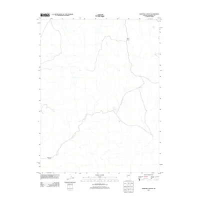
2011 Map of Diamond Canyon
USGS Topo · Published 2011About this map
Diamond Canyon and the surrounding drainage of Diamond Creek define this remote stretch of Churchill County during the early 21st century. The landscape is marked by the seasonal and persistent water sources essential for livestock and wildlife in the Great Basin, including the Diamond Canyon Reservoir and the appropriately named Mud Hole Spring near the northern boundary. The terrain is deeply incised by dry washes and canyons, with Ripley Canyon carved into the hillsides of the eastern half of the map. This 2011 survey captures the area during a period of modern land management, showing a sparse network of unpaved roads and trails that traverse the high desert basins between these drainage features.
Find a feature on this map
5 named features on this map. Tap any name to fly to it.
Don’t see what you’re looking for? This feature index may not catch every label — zoom into the map to look around manually.
Map Details
Editions of this 2011 Diamond Canyon Map
This is the sole edition of this map. No revisions or reprints were ever made.
Other maps of this area

1908 · Carson Sink
USGS Topo · 1:250,000

1910 · Carson Sink
USGS Topo · 1:250,000

1950 · Stillwater
USGS Topo · 1:62,500

1951 · Carson Lake
USGS Topo · 1:62,500

1957 · Reno
USGS Topo · 1:250,000

1959 · Reno
USGS Topo · 1:250,000

1960 · Reno
USGS Topo · 1:250,000

1969 · Table Mtn
USGS Topo · 1:24,000

1969 · Foxtail Lake
USGS Topo · 1:24,000

1972 · Fourmile Flat
USGS Topo · 1:24,000