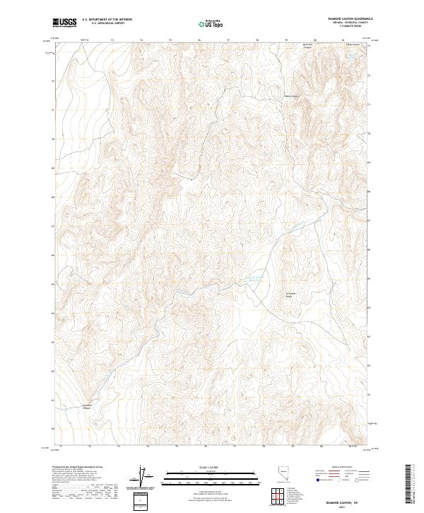
2021 Map of Diamond Canyon
USGS Topo · Published 2021About this map
The Stillwater Range dominates this landscape in Churchill County, where high-desert drainages carve through steep topographic relief. The hydrological character of the region is defined by ephemeral systems like Diamond Cr, which flows through Diamond Canyon toward the Diamond Canyon Reservoir in the central part of the quadrangle. These water features were essential for supporting livestock and early travel in this arid environment. Further north, isolated water sources such as Mud Hole Spring are found within the rugged draws of Mud Hole Canyon. The map reveals a land divided by the Public Land Survey System, showing the intersections of T19N, T18N, R31E, and R32E, a grid that underlies the ranching and resource history of this part of Nevada.
Find a feature on this map
12 named features on this map. Tap any name to fly to it.
Don’t see what you’re looking for? This feature index may not catch every label — zoom into the map to look around manually.
Map Details
Editions of this 2021 Diamond Canyon Map
This is the sole edition of this map. No revisions or reprints were ever made.
Other maps of this area

1908 · Carson Sink
USGS Topo · 1:250,000

1910 · Carson Sink
USGS Topo · 1:250,000

1950 · Stillwater
USGS Topo · 1:62,500

1951 · Carson Lake
USGS Topo · 1:62,500

1957 · Reno
USGS Topo · 1:250,000

1959 · Reno
USGS Topo · 1:250,000

1960 · Reno
USGS Topo · 1:250,000

1969 · Table Mtn
USGS Topo · 1:24,000

1969 · Foxtail Lake
USGS Topo · 1:24,000

1972 · Fourmile Flat
USGS Topo · 1:24,000