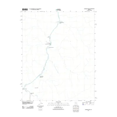
2011 Map of Diamond Peak
USGS Topo · Published 2011About this map
Colorado River navigation and canyon topography define this 2011 survey of the Arizona wilderness. The map documents the specific locations of river hazards essential for navigation, such as Roadrunner Rapids and Granite Spring Rapids. These features are named based on their distance along the river corridor, including the Two Hundred and Seventeenmile Rapids and the corresponding Two Hundred and Seventeenmile Canyon. The drainage patterns show how Diamond Creek and Peach Springs Wash feed into the river system, carving out the massive Diamond Canyon. Rising above the river's edge, Diamond Peak serves as the primary landmark for this stretch of the canyon, surrounded by a network of side canyons like Trail Canyon and Granite Spring Canyon.
Find a feature on this map
16 named features on this map. Tap any name to fly to it.
Don’t see what you’re looking for? This feature index may not catch every label — zoom into the map to look around manually.
Map Details
Editions of this 2011 Diamond Peak Map
This is the sole edition of this map. No revisions or reprints were ever made.
Other maps of this area

1886 · Diamond Creek
USGS Topo · 1:250,000

1892 · Diamond Creek
USGS Topo · 1:250,000

1948 · Williams
USGS Topo · 1:250,000

1954 · Williams
USGS Topo · 1:250,000

1956 · Williams
USGS Topo · 1:250,000

1960 · Williams
USGS Topo · 1:250,000

1961 · Williams
USGS Topo · 1:250,000
1967 · Hockey Puck Spring
USGS Topo · 1:24,000
1967 · Granite Park
USGS Topo · 1:24,000
1967 · Travertine Rapids
USGS Topo · 1:24,000