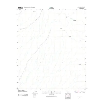
2011 Map of Diaz Peak
USGS Topo · Published 2011About this map
Diaz Peak and the surrounding high desert terrain dominate this Pima County landscape, where the Ajo Range and the Diablo Mountains define the northern and central topography. This 2011 survey illustrates the intricate drainage patterns of the Sonoran Desert, most notably the winding course of the Siovi Shuatak Wash as it moves through the Siovi Shuatak Pass. Human presence is minimal and primarily marked by infrastructure for travel and water access, such as Ajo Mountain Dr and the isolated Manuels Well. The map captures a largely untouched wilderness area, where movement is dictated by geographic gaps like Sweetwater Pass and the towering landmarks of Diaz Spire and the Sierra de Santa Rosa.
Find a feature on this map
10 named features on this map. Tap any name to fly to it.
Don’t see what you’re looking for? This feature index may not catch every label — zoom into the map to look around manually.
Map Details
Editions of this 2011 Diaz Peak Map
This is the sole edition of this map. No revisions or reprints were ever made.
Other maps of this area

1953 · Ajo
USGS Topo · 1:250,000

1954 · Sonoyta
USGS Topo · 1:250,000

1957 · Ajo
USGS Topo · 1:250,000

1958 · Ajo
USGS Topo · 1:250,000

1962 · Ajo
USGS Topo · 1:250,000

1963 · Ajo
USGS Topo · 1:250,000

1963 · Mt. Ajo
USGS Topo · 1:62,500

1963 · Lukeville
USGS Topo · 1:62,500

1963 · Kino Peak
USGS Topo · 1:62,500

1963 · Lukeville
USGS Topo · 1:250,000