
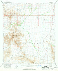
1963 Map of Kino Peak
USGS Topo · Published 1964About this map
The desert frontier of southern Pima County is defined by the meeting of the Cabeza Prieta Game Range and the Organ Pipe Cactus National Monument. This 1963 survey captures a landscape of extreme aridity, where life and travel are dictated by remote water sources like Armenta Well, Bates Well, and Acuna Well. The terrain is dominated by the volcanic forms of the Bates Mountains and Puerto Blanco Mountains, with the prominent spire of Kino Peak serving as a primary landmark. Sparse industrial activity is recorded at the Bluebird Mine and the Copper Mtn mine, while seasonal washes such as Cuerda de Leña and Cherioni Wash provide the only drainage through the stony bajadas and plains of La Abra Plain.
Find a feature on this map
39 named features on this map. Tap any name to fly to it.
Don’t see what you’re looking for? This feature index may not catch every label — zoom into the map to look around manually.
Map Details
Editions of this 1963 Kino Peak Map
2 editions found
Other maps of this area

1932 · Ajo
USGS Topo · 1:62,500

1934 · Ajo
USGS Topo · 1:62,500

1953 · Ajo
USGS Topo · 1:250,000

1954 · Sonoyta
USGS Topo · 1:250,000

1957 · Ajo
USGS Topo · 1:250,000

1958 · Ajo
USGS Topo · 1:250,000

1962 · Ajo
USGS Topo · 1:250,000

1963 · Ajo
USGS Topo · 1:250,000

1963 · Ajo
USGS Topo · 1:62,500

1963 · Sikort Chuapo Mts
USGS Topo · 1:62,500