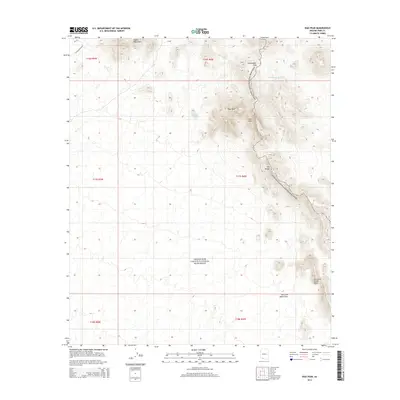
2014 Map of Diaz Peak
USGS Topo · Published 2014About this map
Organ Pipe Cactus National Monument encompasses the vast majority of this landscape, preserving a segment of the Sonoran Desert. The high elevations of the Ajo Range dominate the eastern portion of the sheet, featuring prominent landmarks such as Diaz Peak and Diaz Spire. These peaks overlook a network of seasonal watercourses like Stovi Shuatak Wash, which drain the mountainous terrain. The map also captures the Diablo Mountains in the north and the northern reaches of the Sierra de Santa Rosa to the south. Human imprints are sparse in this protected area, though essential desert infrastructure is noted at Cement Tank and the route through Sweetwater Pass. The topography illustrates the stark transition between the steep volcanic ranges and the alluvial basins typical of southern Pima County.
Find a feature on this map
15 named features on this map. Tap any name to fly to it.
Don’t see what you’re looking for? This feature index may not catch every label — zoom into the map to look around manually.
Map Details
Editions of this 2014 Diaz Peak Map
This is the sole edition of this map. No revisions or reprints were ever made.
Other maps of this area

1953 · Ajo
USGS Topo · 1:250,000

1954 · Sonoyta
USGS Topo · 1:250,000

1957 · Ajo
USGS Topo · 1:250,000

1958 · Ajo
USGS Topo · 1:250,000

1962 · Ajo
USGS Topo · 1:250,000

1963 · Ajo
USGS Topo · 1:250,000

1963 · Mt. Ajo
USGS Topo · 1:62,500

1963 · Lukeville
USGS Topo · 1:62,500

1963 · Kino Peak
USGS Topo · 1:62,500

1963 · Lukeville
USGS Topo · 1:250,000