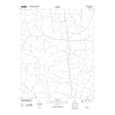
2010 Map of Dibrell
USGS Topo · Published 2010About this map
Sink Creek and Mountain Creek define the drainage patterns of this rural landscape in Warren County, Tennessee. The terrain is marked by a network of local roads such as Gay Rd and Ferrell Rd that connect scattered homesteads and agricultural plots. Family history is deeply rooted here, evidenced by numerous burial grounds including Martin Cemetery, Griffith Cemetery, and Allen Cemetery. Small tributaries like Jones Branch and Clear Springs Branch feed into larger waterways, illustrating the natural water management of the region. The map also shows significant family-named roads like Roy Womack Rd and Newt Johnson Rd, which reflect the localized settlement patterns. This area, largely free from major urban centers, maintains its rural character with features like Bald Knob Rd and Hickory Grove Branch showing the local topography.
Find a feature on this map
87 named features on this map. Tap any name to fly to it.
Don’t see what you’re looking for? This feature index may not catch every label — zoom into the map to look around manually.
Map Details
Editions of this 2010 Dibrell Map
This is the sole edition of this map. No revisions or reprints were ever made.
Other maps of this area

1893 · Mc Minnville
USGS Topo · 1:125,000

1895 · Mc Minnville
USGS Topo · 1:125,000

1942 · Statesville
USGS Topo · 1:100,000

1943 · Cookeville
USGS Topo · 1:100,000

1943 · Mc Minnville
USGS Topo · 1:100,000

1944 · Cookeville
USGS Topo · 1:100,000

1952 · Centertown
USGS Topo · 1:24,000

1953 · Chattanooga
USGS Topo · 1:250,000

1953 · Centertown
USGS Topo · 1:24,000

1953 · Mc Minnville
USGS Topo · 1:24,000