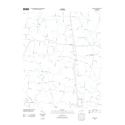
2013 Map of Dibrell
USGS Topo · Published 2013About this map
Dibrell and Lucky anchor this portion of northern Warren County, where the landscape is defined by a dense network of country roads and winding watercourses. The area is marked by established community centers such as Bethel, Green Hill, and Gath, reflecting a long history of rural settlement near the headwaters of Mountain Cr and Sink Cr. This 2013 survey provides a detailed look at the local infrastructure and property divisions, highlighting the continued significance of family-named landmarks and routes. Notable features include the Circle J Tree Farm and the distinct drainages of Hickory Grove Br and Right Fork Dry Br. The map also captures smaller locales like Earleyville and Womack, providing a precise record of the residential and agricultural patterns that have shaped this Tennessee interior over generations.
Find a feature on this map
153 named features on this map. Tap any name to fly to it.
Don’t see what you’re looking for? This feature index may not catch every label — zoom into the map to look around manually.
Map Details
Editions of this 2013 Dibrell Map
This is the sole edition of this map. No revisions or reprints were ever made.
Other maps of this area

1893 · Mc Minnville
USGS Topo · 1:125,000

1895 · Mc Minnville
USGS Topo · 1:125,000

1942 · Statesville
USGS Topo · 1:100,000

1943 · Cookeville
USGS Topo · 1:100,000

1943 · Mc Minnville
USGS Topo · 1:100,000

1944 · Cookeville
USGS Topo · 1:100,000

1952 · Centertown
USGS Topo · 1:24,000

1953 · Chattanooga
USGS Topo · 1:250,000

1953 · Centertown
USGS Topo · 1:24,000

1953 · Mc Minnville
USGS Topo · 1:24,000