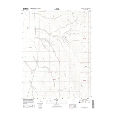
2014 Map of Dickenson Well
USGS Topo · Published 2014About this map
Dickenson Well sits at a remote crossroads in the high desert of White Pine County, serving as a primary landmark in a landscape defined by expansive basins and rising peaks. This area of Nevada is characterized by the broad floor of Long Valley, which transitions into the drainage systems of Long Valley Canyon and Burnt Canyon. To the southeast, the terrain climbs toward the Butte Mountains, showing the characteristic basin and range topography common to the eastern part of the state.
Find a feature on this map
11 named features on this map. Tap any name to fly to it.
Don’t see what you’re looking for? This feature index may not catch every label — zoom into the map to look around manually.
Map Details
Editions of this 2014 Dickenson Well Map
This is the sole edition of this map. No revisions or reprints were ever made.
Other maps of this area

1951 · Illipah
USGS Topo · 1:62,500

1956 · Ely
USGS Topo · 1:250,000

1959 · Ely
USGS Topo · 1:250,000

1959 · Reipetown
USGS Topo · 1:62,500

1963 · Ely
USGS Topo · 1:250,000

1979 · Mt. Hamilton
USGS Topo · 1:100,000

1982 · White Sage Well
USGS Topo · 1:24,000
1982 · McBrides Sheep Well
USGS Topo · 1:24,000

1982 · Dickenson Well
USGS Topo · 1:24,000

1982 · Sunshine Well
USGS Topo · 1:24,000