
2021 Map of Dickenson Well
USGS Topo · Published 2021About this map
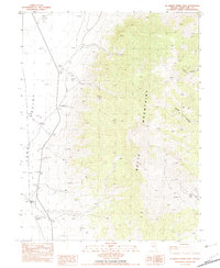
Long Valley dominates this high-desert landscape in White Pine County, showing the characteristic basin and range structure of eastern Nevada. The area is defined by the steep rises of the Butte Mountains to the southeast, which contrast with the broad drainage paths of Long Valley Canyon and Burnt Canyon. These natural corridors reveal how water and gravity shaped the Great Basin over millennia. Human presence in this isolated reach is primarily marked by rural infrastructure, specifically White Pine Co Road 3 and White Pine Co Road 8, which follow the valley floor and cut through the low passes. This survey provides a precise look at the land division system within Township 19 North and Township 20 North, essential for understanding land use and boundary history in this arid interior.
Find a feature on this map
10 named features on this map. Tap any name to fly to it.
Don’t see what you’re looking for? This feature index may not catch every label — zoom into the map to look around manually.
Map Details
Editions of this 2021 Dickenson Well Map
This is the sole edition of this map. No revisions or reprints were ever made.
Other maps of this area

1951 · Illipah
USGS Topo · 1:62,500

1956 · Ely
USGS Topo · 1:250,000

1959 · Ely
USGS Topo · 1:250,000

1959 · Reipetown
USGS Topo · 1:62,500

1963 · Ely
USGS Topo · 1:250,000

1979 · Mt. Hamilton
USGS Topo · 1:100,000

1982 · White Sage Well
USGS Topo · 1:24,000
1982 · McBrides Sheep Well
USGS Topo · 1:24,000

1982 · Dickenson Well
USGS Topo · 1:24,000

1982 · Sunshine Well
USGS Topo · 1:24,000